
· Travel · 5 min read
Azzaden Valley Trek: A 3-Day Route from Imlil to Ouirgane
Azzaden Valley trek from Imlil to Ouirgane in three days: stage distances, pass heights, gîtes, mules and when a licensed guide matters.
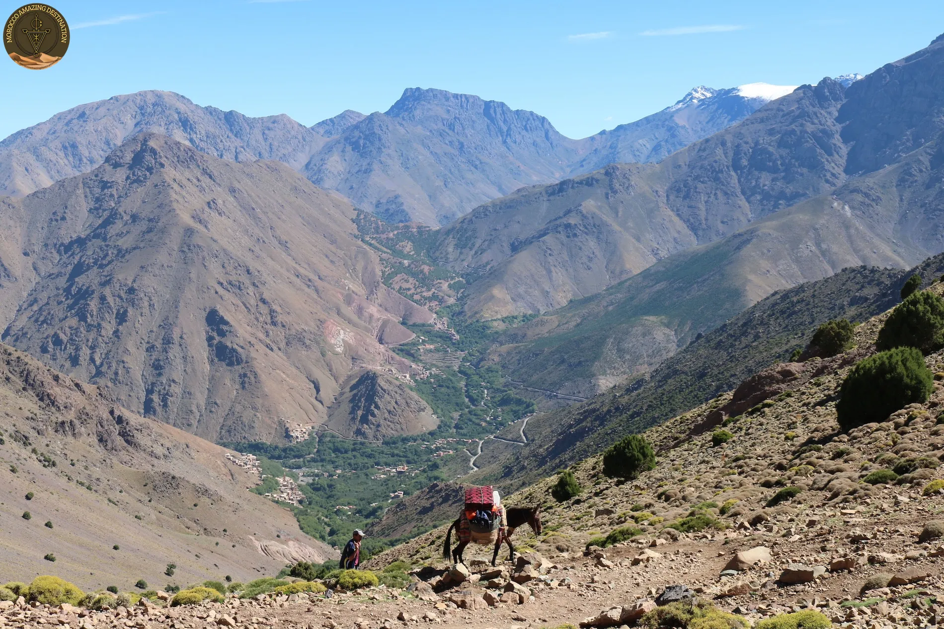
At Imlil the tarmac ends and the choice begins. Almost every pair of boots turns uphill toward Toubkal, and by mid-morning the trail to the refuge is a queue. Walk west along the Azzaden side instead, and the voices thin out within an hour.
The Azzaden Valley trek is a three-day, roughly 30 km route from Imlil over the Tizi Mzik and Tizi n’Oudid passes to Ouirgane. You walk four to six hours a day and sleep in village gîtes. This guide covers the stages, heights, beds and the honest difficulty, so you know what you are signing up for before you book.
Atlas Mountains Multi-Day Trek: The Azzaden Line in Three Days
This is the atlas mountains multi-day trek between two roadheads. Imlil sits at about 1,740 m and Ouirgane at about 1,000 m, with one serious pass on the first day.
- Distance: about 28 to 32 km in total, split across three walking days.
- High point: the Tizi Mzik pass at about 2,490 m on day one.
- Low point: Ouirgane at about 1,000 m, reached on the third afternoon.
- Direction: walkable both ways, and the figures barely change.
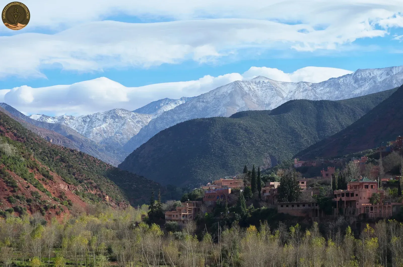
Ouirgane sits 65 km south of Marrakech on the S501, 14 km southwest of Asni and beside the Yacoub el Mansour reservoir. The line runs inside Toubkal National Park, so the ground is protected the whole way. Most itineraries are sold as a trekking imlil to ouirgane route with two village nights in between. Our guide to Atlas hiking tours from Marrakech sets those options side by side.
Day One: Imlil to Tizi Oussem via the Tizi Mzik Pass
You leave Imlil at about 1,740 m, roughly 90 minutes by road from Marrakech. The path climbs through walnut terraces and juniper, shaded by the valley walls in the morning and open higher up. It reaches the Tizi Mzik pass at about 2,490 m, then drops hard into the Azzaden.
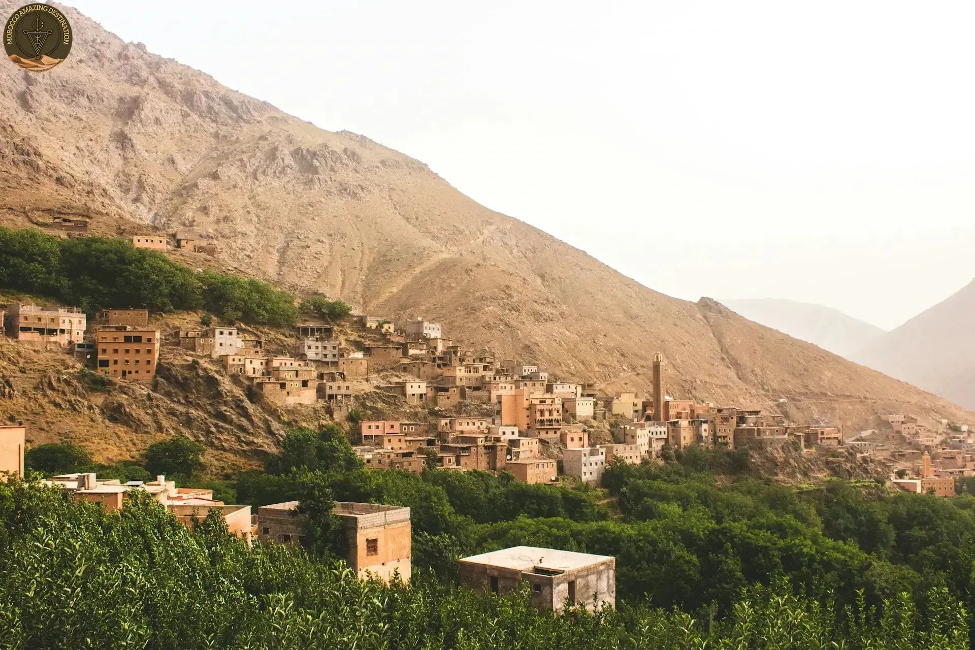
Expect 8 to 10 km and four to six hours, with around 750 m of ascent. The descent is the part most people underestimate: loose stone, mule traffic and a long run down to Tizi Oussem at about 1,850 m. Nothing technical, but the stone is polished by hooves and slick after rain.
Want a shorter taste of the same valleys before committing to three days? Our guide to the valleys around Marrakech covers the day-sized alternatives.
Days Two and Three: Tamsoult, Tizi n’Oudid and the Drop to Ouirgane
Day two is the quiet one. You climb from Tizi Oussem through Id Aissa toward Azib Tamsoult at about 2,300 m. That is 10 to 12 km and five to six hours, with the Ighouliden falls a short detour off the main line.
The Tizi n’Oudid pass arrives on day three at around 2,000 m. Operators label this Ouirgane-side descent differently: some say Tizi n’Oudid, others Tizi Ouirgane or Tizi n’Techt. Confirm the name on your own itinerary.
From there the path loses roughly 1,200 m to Ouirgane, 8 to 10 km in four to five hours. The reservoir shows up long before the road does. Walk the line in reverse and it builds gradually, with Tizi Mzik saved for the last morning.
Gîtes, Mules and Faint Trails: What Support Really Buys
A gîte is a village house with rooms set aside for walkers, and the standard is simple. You get a bed and bedding, dinner and breakfast cooked in the house, and somewhere to dry your boots.
- A bed and blankets: shared rooms are normal, and bedding comes with the room.
- Dinner and breakfast: cooked in the house, often tagine, bread and mint tea.
- Washing water: ask what is available before you count on a hot shower.
- Your duffel, carried: mules take roughly 15 kg per trekker, and your daypack stays with you.
Mules cannot follow rock steps or the waterfall path, which is why the daypack stays on your back. On day two the trail braids into livestock paths and side streams, and one wrong junction costs an hour. Support buys a lighter pack and less time spent looking for the path.
How Hard It Is, and When a Licensed Guide Becomes Non-Negotiable
Moderate is the fair label. Three days of four to six hours, one pass near 2,500 m and a long final descent. If you can walk hills all day with a light pack, this route is within reach.
Altitude is rarely the problem here. The high point sits below the 3,000 m band where altitude sickness usually starts. Heat, wind on the passes and streams rising after rain cause more trouble.
A licensed guide is expected on this route, and every operator working out of Imlil treats it as compulsory. Moroccan mountain guides train for around six months at the school near Tabant and register with the Ministry of Tourism.
- Day one: the path is obvious, and self-guided walkers manage it.
- Day two: braided trails, streams and few signs, so a guide matters.
- Whole route: operators out of Imlil will not send you without one.
March to May and September to November are the best months to walk it. December to February can put snow on Tizi Mzik, and July and August reward a 6 a.m. start.
Three days is enough to cross from one valley into another and watch the water change from irrigation channels to a reservoir. It fits inside a longer Morocco trip without eating the whole holiday.
Our Atlas Mountains day trip from Marrakech is a good way to test one graded day in the same valleys before committing to three. For a longer loop that adds the desert and the Atlantic coast, the 8-day Morocco tour from Marrakech builds on the same High Atlas crossing.
We can customize a tour to match your needs - design your perfect itinerary
If you found this helpful, add us as your preferred source on Google.
Frequently Asked Questions
How long is the Azzaden Valley trek and how far do you walk each day?
Three days, about 28 to 32 km in total. Day one runs 8 to 10 km in four to six hours, day two 10 to 12 km in five to six hours, and day three 8 to 10 km in four to five hours with a long descent to Ouirgane.
Do you sleep in gîtes or camp on the Azzaden route?
Village gîtes are the norm, at Tizi Oussem on the first night and usually at Azib Tamsoult on the second. Camping is possible, but you would carry the tent and the food yourself, because the mules only take duffels.
Which direction is easier: Imlil to Ouirgane, or Ouirgane to Imlil?
Imlil to Ouirgane puts the big climb on day one, while walking from Ouirgane builds gradually and saves the Tizi Mzik descent for the last morning. Most trekkers start at Imlil because transport from Marrakech is easier.
How high are the passes, and is altitude a problem?
Tizi Mzik is about 2,490 m and Tizi n'Oudid is around 2,000 m, with the second night at Azib Tamsoult around 2,300 m. The route stays below the 3,000 m band where altitude sickness usually begins, so breathlessness is far more likely than real altitude trouble.
Ready for an Adventure?
Have questions? Feel free to contact us using the form below. We're here to help!