· Travel · 9 min read
Rivers of Morocco: A Complete Guide to the Country's Major Rivers
Discover the major rivers of Morocco, from the Draa to the Oum Er-Rbia. Complete guide to the country's waterways, geography, and their role in Moroccan life.
Morocco is a country of striking geographic contrasts — from snow-capped peaks to vast desert expanses, and from rugged coastlines to lush valleys carved over millennia. Running through this diverse landscape is a network of rivers that have shaped the country’s history, agriculture, and way of life. Understanding the rivers of Morocco is key to understanding the country itself — where cities were built, where crops flourish, and where life finds a way in an otherwise arid land.
The major rivers in Morocco flow from the country’s mountainous heart toward three distinct watersheds: the Atlantic Ocean, the Mediterranean Sea, and the Sahara Desert. This natural architecture means that Morocco’s rivers are as diverse as the regions they traverse.
The Atlantic Watershed
The Atlantic seaboard receives the largest number of Morocco’s rivers, fed by the snowmelt and rainfall of the Middle Atlas and High Atlas mountains. These rivers sustain the most fertile agricultural plains in the country.
Oum Er-Rbia — The Mother of Spring
The Oum Er-Rbia river is one of Morocco’s most significant waterways. Its name, meaning “Mother of Spring” in Arabic, reflects its perennial flow and life-giving properties. Stretching approximately 600 kilometers, it originates in the Middle Atlas at an altitude of 1,240 meters and winds its way to the Atlantic Ocean near Azemmour.
What makes the Oum Er-Rbia remarkable is its role as the backbone of Morocco’s hydroelectric and irrigation network. Along its course, eight major dams have been built — including the impressive Bin El Ouidane dam — generating power and irrigating over 100,000 hectares of farmland. The Oum Er-Rbia never completely dries up, making it one of the few truly permanent rivers in Morocco.
Sebou — The Powerhouse
If any river deserves the title of Morocco’s most important, it is the Sebou. Flowing approximately 450 kilometers from the Middle Atlas to the Atlantic Ocean near Kenitra, the Sebou carries nearly 50% of the country’s total surface water. Its watershed is the most productive agricultural region in Morocco — the fertile Gharb plain produces rice, wheat, sugar beets, olives, and citrus fruits.
The Sebou’s lower course is navigable for about 17 kilometers inland from its mouth, making it unique among Moroccan rivers. The city of Kenitra, built at the river’s estuary, serves as an important inland port. The river’s major tributaries include the Ouergha, Baht, and Inaouen, together forming a vast drainage basin that sustains millions of people.
Bou Regreg — The Capital’s River
The Bou Regreg flows 240 kilometers from the Middle Atlas to the Atlantic, but it is best known for the stunning estuary that separates Rabat from Salé. This river mouth created one of the most strategic harbors on the Atlantic coast, giving rise to the twin cities that form Morocco’s capital region. Today, the Bou Regreg is a symbol of urban life, lined with promenades and crossed by bridges connecting the modern and historic halves of the capital.
Tensift — Marrakech’s Lifeline
The Tensift River originates in the High Atlas and flows approximately 270 kilometers past Marrakech to the Atlantic near Essaouira. Despite its length, the Tensift has an extremely irregular flow — it can swell dramatically after mountain snowmelt and rainfall, yet it nearly dries up during summer. Its waters irrigate the Haouz plain, one of Morocco’s most important agricultural regions, and its valley has been farmed since ancient times.
Souss — The Southern Valley
The Souss River flows through the fertile Souss-Massa region in southern Morocco, draining the western Anti-Atlas and High Atlas before reaching the Atlantic near Agadir. Its 130-kilometer course supports intensive agriculture — notably argan groves, citrus orchards, and vegetables. The river’s estuary is a protected Ramsar wetland site, home to diverse bird species including flamingos and the rare northern bald ibis.
The Mediterranean Watershed
A smaller number of rivers drain northward into the Mediterranean Sea, but their importance to northern Morocco is immense.
Moulouya — The Largest Basin
The Moulouya River holds the distinction of having the largest drainage basin of any Moroccan river — some 54,500 square kilometers. Flowing approximately 520 kilometers from the Middle Atlas northeastward and then northward to the Mediterranean, the Moulouya is also the only permanent river reaching the Mediterranean coast.
The river’s delta near Saidia is a protected Ramsar wetland of outstanding biological importance, covering 3,000 hectares of marshes and lagoons. It serves as a critical stopover for migratory birds traveling between Europe and Africa. Two major dams — Mechra Homadi and Mohamed V — regulate its flow for irrigation and drinking water.
Historically, the Moulouya formed a significant boundary: it marked the eastern limit of the Spanish Protectorate in northern Morocco and, centuries earlier, the border between the Roman provinces of Mauretania Tingitana and Mauretania Caesariensis.
Laou and Loukkos — The Rif’s Rivers
The Laou River (Wad Laou) and the Loukkos River are the principal waterways of the Rif Mountains in the far north. The Loukkos, about 120 kilometers long, flows through a region of exceptional biodiversity near Larache, sustaining sugarcane fields and wetlands that harbor hundreds of bird species. Its clear waters and lush surroundings make it one of the most picturesque rivers in Morocco.
The Saharan and Pre-Saharan Rivers
South of the Atlas Mountains, rivers face a dramatically different fate. Instead of reaching the sea, they flow toward the Sahara, creating life-sustaining oases before disappearing into the desert.
Draa — The Longest River in Morocco
The Draa River holds the title of Morocco’s longest river at approximately 1,100 kilometers. It forms at the confluence of the Dades and Imini rivers in the High Atlas and flows southeast toward the Sahara. However, the Draa is a river of contradictions — while its upper course flows abundantly, its lower 750 kilometers are usually dry, with water filtering underground through the desert sands. Only in exceptionally rainy years does the Draa reconnect with the Atlantic Ocean.
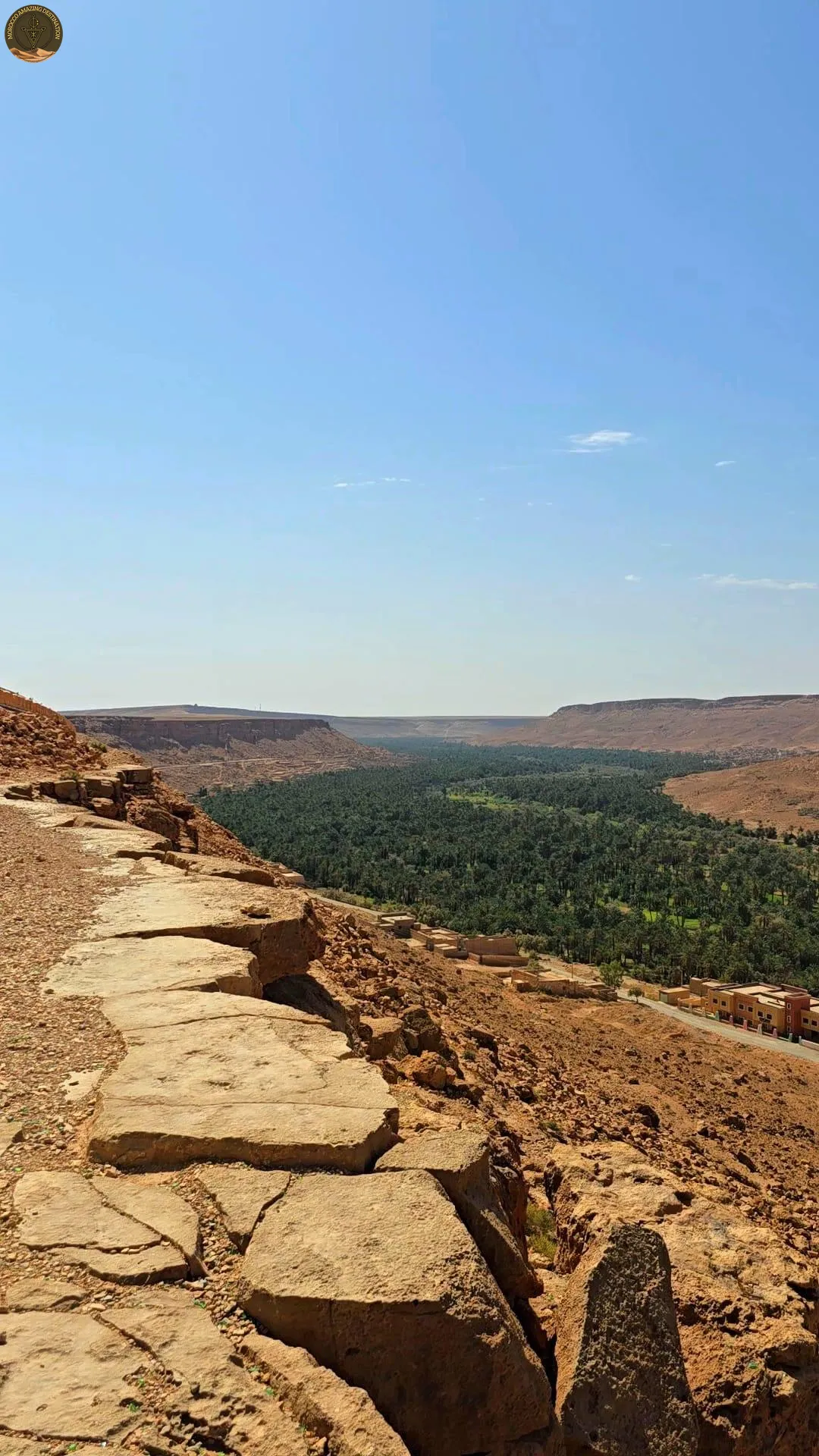
Despite this, the Draa Valley is one of Morocco’s most remarkable cultural landscapes. A string of oases, palm groves, and fortified kasbahs follows the river’s ancient course, creating a corridor of life that has sustained communities for millennia. Driving the Draa Valley road is one of the most scenic experiences in Morocco, with date palms stretching as far as the eye can see against the ochre-colored desert.
Ziz and Gheris — Desert Oasis Makers
The Ziz River flows 331 kilometers from the High Atlas into the Sahara, where it waters the Tafilalet oasis — the largest oasis in Morocco and the cradle of the Alaouite dynasty that still rules the country today. The Ziz Gorge, carved through limestone cliffs on the way to the desert, is a dramatic natural wonder offering breathtaking views. Along its course, vast date palm plantations produce some of the finest dates in North Africa.
The Gheris River runs parallel to the Ziz, also flowing south into the desert. Together, these rivers create the extraordinary green corridor that contrasts so strikingly with the surrounding desert landscapes — a sight that never fails to impress travelers crossing the High Atlas toward Merzouga.
Dades and Todra — Sculptors of Canyons
The Dades River gives its name to one of Morocco’s most famous valleys and is a major tributary of the Draa. Over millions of years, it carved the Dades Gorge, a winding canyon with striking red rock formations known as “the monkey fingers.” Nearby, the Todra River created the even more dramatic Todra Gorge, where vertical limestone walls rise up to 300 meters, making it a world-class destination for rock climbing and hiking.
These rivers, though modest in volume, have shaped some of the most spectacular scenery in Morocco. Travelers on the classic route from Marrakech to the Sahara invariably pass through these valleys, where the contrast between lush river-fed vegetation and the arid highlands is unforgettable.
The Importance of Rivers in Morocco
Morocco’s rivers are far more than scenic attractions — they are the country’s lifelines. In a nation where much of the land receives less than 300 millimeters of rainfall per year, rivers provide the water that makes agriculture, industry, and daily life possible.
Agriculture depends overwhelmingly on river-fed irrigation. The Sebou, Oum Er-Rbia, and Tensift basins alone support the majority of Morocco’s crop production, from cereals and olives to citrus fruits and vegetables destined for European markets. Without these waterways, Morocco’s role as a major food exporter would be impossible.
Hydroelectricity is a cornerstone of Morocco’s renewable energy strategy. The dams along the Oum Er-Rbia and Moulouya generate significant amounts of clean electricity, reducing the country’s dependence on fossil fuels. Morocco has built over 140 large dams — one of the highest per-capita dam capacities in Africa — reflecting the strategic importance of its rivers.
Urban water supply is equally critical. The Bou Regreg supplies Rabat, the Oum Er-Rbia provides water to Casablanca through an extensive pipeline system, and the Sebou serves Fes and Kenitra. Morocco’s growing cities would simply not exist without these rivers.
However, challenges remain. Climate change, prolonged droughts, and increasing water demand put pressure on Morocco’s rivers. Sustainable management of this precious resource is one of the country’s top priorities.
Explore Morocco’s River Landscapes with Guided Tours
The best way to appreciate the rivers of Morocco is to see them in person — to watch the Ziz carve through the High Atlas, to walk the palm-filled Draa Valley, and to stand beneath the towering walls of Todra Gorge. A 4-day Morocco desert tour from Marrakech takes you through the dramatic Dades Valley and its ancient river-carved landscapes, combining the beauty of southern Morocco’s waterways with the magic of the Sahara Desert.
For a deeper journey, the 4-day trip from Marrakech to Fes via Dades and Merzouga follows the route of the Dades River, crosses the spectacular Todra Gorge, and traces the Ziz Valley toward the golden dunes of Erg Chebbi — an unforgettable cross-section of Morocco’s geography where rivers, mountains, and desert converge in a single breathtaking itinerary.
If you found this helpful, add us as your preferred source on Google.
Frequently Asked Questions
What are the main rivers of Morocco?
The main rivers of Morocco are the Draa (the longest at approximately 1,100 km), the Oum Er-Rbia, the Sebou, the Moulouya, the Tensift, the Bou Regreg, and the Souss. Morocco's rivers are grouped into three watersheds: Atlantic, Mediterranean, and Saharan.
What is the longest river in Morocco?
The Draa River (Oued Draa) is the longest river in Morocco, stretching approximately 1,100 kilometers. It originates in the High Atlas Mountains and flows south toward the Sahara. However, its lower course is intermittent and often dries out before reaching the Atlantic Ocean.
What is the most important river in Morocco?
Many consider the Sebou to be Morocco's most important river. It carries nearly 50% of the country's surface water and is crucial for agriculture in the Gharb plain. In terms of hydroelectric power and irrigation, the Oum Er-Rbia is equally vital with its series of eight dams.
Do Morocco's rivers flow all year round?
Only some rivers in Morocco flow year-round as permanent rivers. The Sebou and Oum Er-Rbia maintain a continuous flow, while the Oum Er-Rbia never completely dries up. Many rivers like the Draa, Tensift, and Ziz are seasonal or intermittent, with reduced or zero flow during the dry summer months.
Ready for an Adventure?
Have questions? Feel free to contact us using the form below. We're here to help!